

3D Mapping with RTK drones
Our RTK drones enable clients to create highly-accurate maps and point clouds to take measurements from, discover costly mistakes, and predict delays. It also saves countless site visits saving up to thousands of pounds per week.
So what is drone mapping?
We use our highly accurate RTK drones to capture 100's of geo-referenced
images which are then uploaded and processed through some sophisticated software.

The software then stitches all the images together to create 2D orthomosaic maps and 3D models of your project.
This data can then be used to take accurate measurements and volumetric calculations as well as enabling the client to add labels and create issues which in turn can be commented on by other stakeholders.
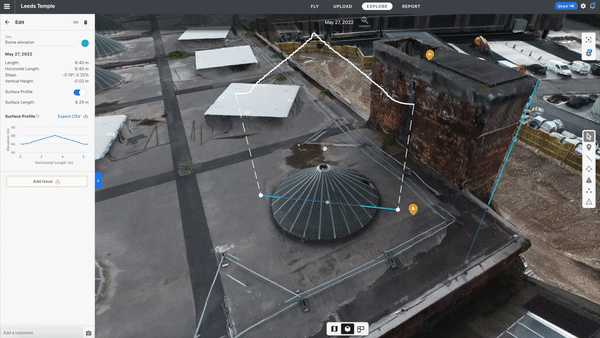
The software we use is cloud based so there's no need for super powerful computers and it's accessible from wherever you have an internet connection.
All you have to do is give me the day and the location and you will never have to visit site again, unless of course you want to!
For more details please contact me or take a look at this video presentation